Chaco Sites
Shabik’eshchee


Using this Map:
Click on the map image to launch full-size, interactive map.
When you select an individual room or kiva context on the larger map, a pop-up window will appear displaying information categories from our database available for that context (Artifacts, Burials, Tree-Ring Dates, and Features).
Each of the categories can be expanded by clicking the ‘+’ to reveal an abridged list of basic information. Selecting the category heading itself will open a separate window with complete details.
Site Description
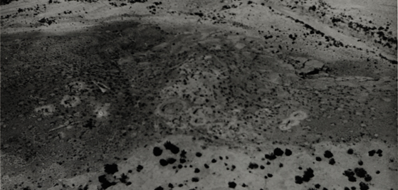
Shabik’eshchee is a large Basketmaker pithouse village about 6.8 miles (11.0 km.) southeast of Pueblo Bonito on the northern escarpment of Chacra Mesa, overlooking Chaco Wash. Shabik’eshchee is one of the best known pithouse villages in the Four Corners region and is often discussed as one of the type sites for the region. Frank H. H. Roberts excavated a portion of the site during 1926 and 1927 for the Smithsonian’s Bureau of American Ethnology and additional work was conducted in 1973 and Alden Hayes and John Thrift of the National Park Service. The site name may be a misspelling of the Navajo “Tsé Bik’ e’eschí” or “graven rock” (Linford 2000).
Roberts identified 19 pithouses, 45 storage cists, and a great kiva, but he did not believe all the pithouses were occupied at the same time. Roberts also identified some structures northwest of the primary area he explored and he excavated a few of them, including a later Pueblo I period pithouse that he called a “proto-kiva.” He regarded the structures to the northwest as a separate occupation from Shabik’eshchee, but the later work by the National Park Service determined that the distributions are continuous and contemporaneous enough to be considered a single settlement. The new fieldwork also concluded there may be as many as 49 additional structures to the northwest of those explored by Roberts. Subsequently, two Chacoan researchers, Wirt Wills and Thomas Windes (1989), have proposed three clusters of pithouses can be identified. They believe the village may have served as a seasonal gathering place for Basketmaker families who lived in smaller hamlets scattered through the region during the rest of the year.
Tree-ring dates place construction of the great kiva in the mid-A.D. 500s; ceramics from the settlement, primarily Lino Gray and La Plata Black-on-white, are consistent with that time period. Some occupation also may have occurred in the early 700s. The proto-kiva, courtyard, and a few pithouses may represent a Pueblo I reoccupation of the site sometime after A.D. 700 (Vivian and Hilpert 2002:217-219).
Alternative site designations are 29SJ1659, LA 539, Bc 256, and LA 41659.
Excavation History
- 1926-1927: Excavated by Frank H. H. Roberts, Jr. of the Smithsonian's Bureau of American Ethnology
- 1973: Excavated by Alden C. Hayes and John Thrift of the National Park Service
Size and Dates
- More than 64 pithouses and 48 storage bins, one great kiva, and three small trash middens.
Site and Room Data
- Aztec West Ruins
- Bc 50 - Tseh So
- Bc 51
- Bc 53 - Roberts' Site
- Bc 57
- Bc 58
- Bc 59
- Chetro Ketl
- Pueblo Bonito
- Pueblo del Arroyo
- Shabik'eshchee
- Talus Unit #1
